
 Image 1 of 9
 Image 2 of 9
 Image 3 of 9
 Image 4 of 9
 Image 5 of 9
 Image 6 of 9
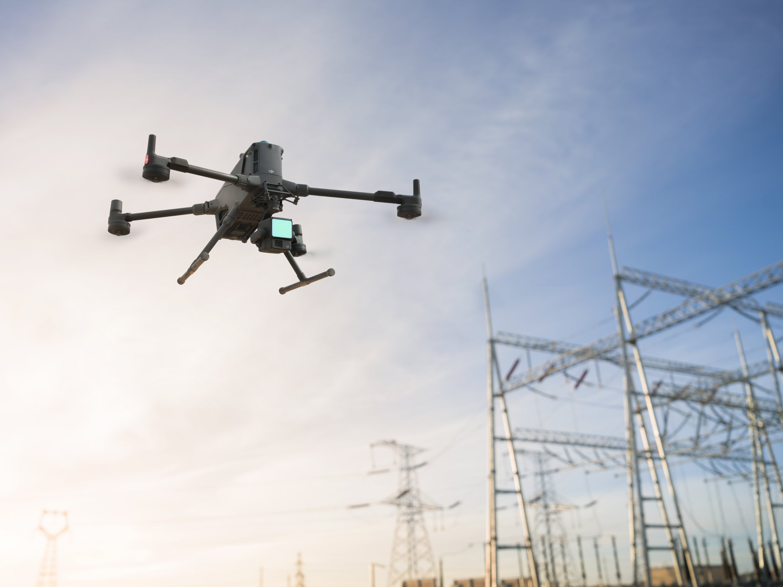 Image 7 of 9
 Image 8 of 9
 Image 9 of 9
Recommended for These Industries
Public Safety & Rescue
Quickly locate people or vehicles with infrared and visual detection
Use speakers and spotlights during night ops or crowd control
Reliable flight even in tough terrain or low light
Suggested Setup: M400 + H30T Camera + Speaker V1 + Spotlight S1
Firefighting & Emergency Response
Real-time terrain following makes flying in smoke or hills easier
Spotlights and tethered power systems support continuous lighting
Maritime Patrol
Take off and land from vessels
Detect and count vessels or use loudspeakers and lights at sea
Surveying & Mapping
Fly faster (up to 25 m/s) and cover more ground in less time
Supports mapping routes: ortho, oblique, slope, 3D and more
Suggested Setup: M400 + L2 or P1 Camera
Utilities & Infrastructure
Ideal for powerline inspections with Lidar and obstacle avoidance
Relay mode helps keep signal even in mountainous regions
Suggested Setup: M400 + L2 or H30T
Renewable Energy
Inspect wind turbines, solar fields, and offshore sites safely and efficiently
Handles heavy payloads and tough weather conditions
Specialised Applications
Long-duration lighting with tethered battery systems
Supports 3rd-party cleaning tools and advanced sensors like UV, multispectral, and long-range radar
Suggested Setup: M400 + tethered system or 3rd-party device
Built to Do More
With its upgraded endurance, smart automation, and high-performance hardware, the DJI Matrice 400 is the ideal solution for professionals who demand efficiency, safety, and versatility.
Ready to expand your drone capabilities?
Explore our M400 bundles or speak to our team for a custom configuration.